
The Okanogan Country Travel Planner is produced annually by the Okanogan County
Tourism Council. No portion of this guide may be reproduced without permission of
OCTC.While every effort has been made to ensure accuracy of information, we will
not be held liable for inaccurate information.
Design & Layout by Earth & Sky Studios, LLC
Thank you to all our generous photo contributors:
Justin Haug • Ken Gray • Methow Valley Photography Okanogan County
Historical Society Richard Reis • Tim Patrick • Tom Riechner
Getting Here:
Grand Coulee Dam. At the junction,
take Hwy 155 north towards Elmer City,
Nespelem, and Omak, or continue west to
travel towards Bridgeport, Pateros, and the
Methow Valley.
From Kelowna, BC:
From Kelowna, BC, follow the signs for
BC-97 south to Osoyoos. Just past Osoyoos
on BC-97, cross the US/Canadian border
and continue on Hwy 97 to Oroville, the
northern gateway to Okanogan Country.
For
Border Crossing
info, please see:
www.ezbordercrossing.com/washington-state/oroville-osoyoos/
From the Seattle/Tacoma Area:
A) Take I-90 to Snoqulamie Pass, Cle Elum then take
exit 85 for WA-970 to Wenatchee.
B)Take I-5 North to Everett or Hwy 522 to Monroe.
Follow Stevens Pass, Hwy 2, east to Wenatchee.
Then
Continue on Hwy 2 following signs to East
Wenatchee/Okanogan, crossing the Columbia River.
Take Hwy 97 north (turn left at the junction) and
continue north to Pateros, the southern gateway to
Okanogan Country.
Alt. Route: North Cascades Hwy (closed in
winter):
Take I-5 North to Burlington and follow the
signs to Hwy 20. Follow the Cascades Scenic Byway
through Sedro-Woolley and continue as you travel
through North Cascades National Park and Ross Lake
National Recreation Area before dropping down into
Mazama and Winthrop, the entryway to the scenic
Methow Valley and Okanogan Country.
From Spokane:
From Spokane, take Hwy 2 west towards Davenport.
Just past Wilbur, turn north on Hwy 174 towards
North
Okanogan
Region
Table of Contents
Methow
Heart of Okanogan
North Okanogan
Columbia River
Restuarants, Bistros, etc
AgTourism,Tours
Arts & Culture
Birdwatching /Wildlife
Sportsman’s Guide
Traveler Resources
Outfitters, Shopping
National / State Park
WalkingTrails
Summer Map & Guide
Winter Map & Guide
Columbia River Map
Highland Driving Map
Many Lakes Map
Lodging
Camping / RVs
4
6
8
10
12
16
18
20
22
24
25
26
27
28
32
36
40
44
46
50
Photo on cover of Fort
Okanogan State Park
courtesy of JasonWettstein
This publucation funded in
part by Okanogan County
Hotel/Motel LodgingTax
Fund
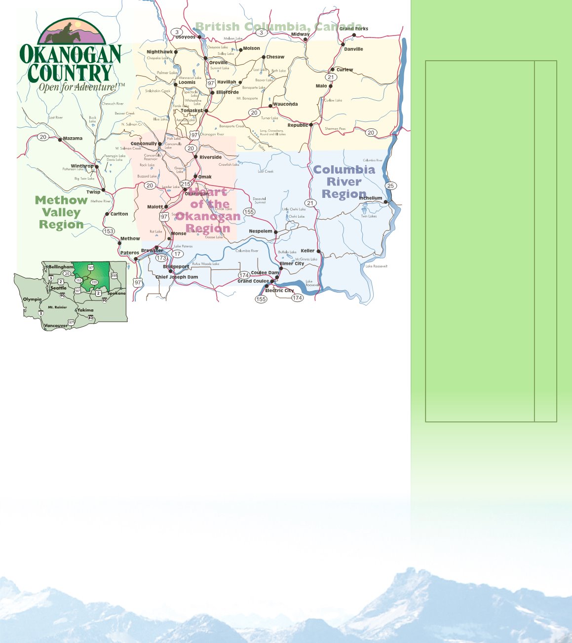
Located in sunny North Central Washington, here’s how to get to Okanogan Country.
3


